- November 4, 2021
- JCRMO
- Blog
- No Comments


Regulating water use in woody crops with Remote Sensing
How much should I irrigate? When should I irrigate? These are vital decisions that irrigators need to make daily. Some use scheduling programs. Others manually read soil moisture sensors. Others make decisions based on water district schedules. And yet others rely on models that are supported by Earth Observation (EO) satellites. Remote sensing tools can group woody crops according to their’ drinking needs’. This grouping helps farmers determine the amount of water they need to budget for those crops in irrigated areas. Categorising drinking needs allows the application of practical and effective standards in the control of water use.
What are woody crops?
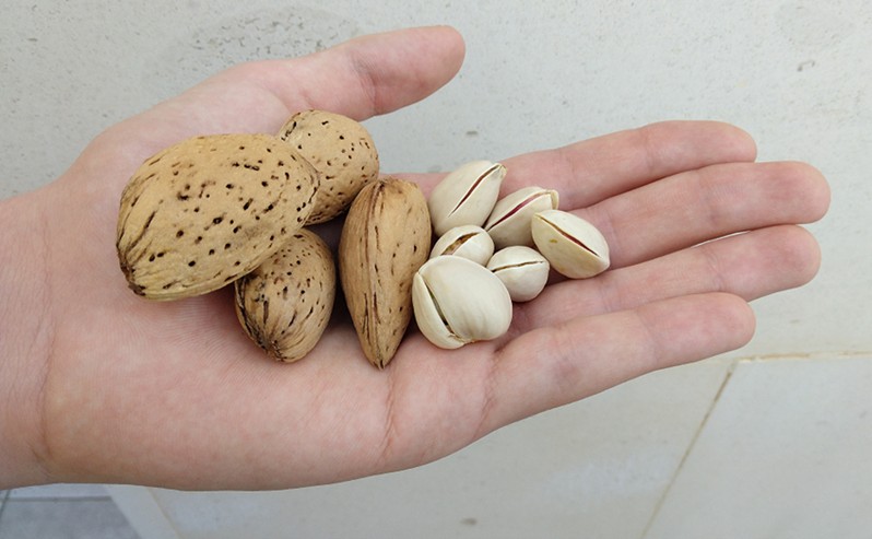
Irrigated woody cultivation of almonds, pistachio and olive trees is expanding in the dry region of La Mancha Oriental (Spain). The increase is due to the high prices of almonds and the low prices of cereals in the international market, making almond farms more profitable. These woody crops have a great adaptation to water stress. Irrigation application differs from support irrigation (1,500 m3 / ha) to intensive production (5,000 m3 / ha).

How is water use measured in woody crops?
The standard in La Mancha Oriental allows farmers to choose between two systems for measuring their water consumption:
1. Measurement using volumetric counters

2. The following table shows water consumption per crop type. This table categorises water consumption using the Normalised Difference Vegetation Index (NDVI). An indicator of vegetation health that we derive from data the Sentinel-2 satellite collects
| Woody Crops | Water Consumption (M3 / Ha) |
| Almond, Support Irrigation | 1800 |
| Olive, Pistachio and Vineyard, Support Irrigation | 1500 |
| .Almond, Pistachio, Olive (0.35 <= NDVI < 0.45) | 3000 |
| Almond, Pistachio, Olive (0.45 <= NDVI < 0.55) | 4000 |
| Almond, Pistachio, Olive (NDVI >= 0.55) | 5000 |
Both systems require surveillance to verify the integrity of the farmer’s declaration and check the volumetric counter is operating correctly.
Methodology applied in this control system
We conducted collaborative studies between users, the state water administration ‘Confederación Hidrográfica del Júcar’, the university, and the irrigation advisory service. These studies have helped us determine relationships between the water woody crops need and the EO vegetation indices (NDVI). The NDVI is directly related to the number of green leaves in the crop.
The following image is an example of the vegetation indices we observed in 3 plots of adult almond trees. Each field has different doses of irrigation water:

We summarised our results in groups of crop water consumption, using the NDVI values of the summer months as reference. This information makes it possible to apply a practical and effective standard in the control of water uses.

The volume measured by the volumetric counters can be compared to the estimated irrigation volume by remote sensing. The deviation between the two data makes it possible to locate if the equipment has a malfunction.
Below we show an example where NDVI-based calculations estimated water consumption of 4000 m3 per hectare for the crop type and plot size. Instead, the water counter recorded usage ten times lower.

Verification of the crop declared by the farmers.
Before starting the irrigation campaign, the farmers are informed of the water consumption in the woody crop plots. This information refers to plots where there is a difference between the declaration and remote sensing observation.
The reported water consumption is deducted from the water concession granted to farmers. The farmers have to schedule the remaining allocation to the needs of the other crops to avoid exceeding their authorised volume.


Benefits
The use of remote sensing in La Mancha Oriental allows the control of water consumption in some 18400 plots of woody crops and the monitoring of the correct operation of 3700 water meters, distributed in an area of 9968 km2.
This information makes it possible to locate the plots and wells that should be inspected with an objective selection criterion. This method saves labour and material resources.