


We have an incredibly talented and experienced team who are extremely passionate about developing Copernicus-based information service for irrigation and nutrient management for the Australian agricultural systems.

- Irrigation advisory service based on Satellite Data;
- Detection of Irrigated plots, based on EO multi temporal vegetation status monitoring.
- Land use and land cover mapping
- Web GIS and Spatial DSS: Solutions for geographic data processing, spatial geo-database management and web publication.
-
data acquisition by ground, air and satellite-borne devices,
-
data processing, data analysis,
-
modelling and visualisation across a variety of thematic applications of such technologies and techniques.
- Food security, through irrigation in agriculture;
- Environmental protection;
- Land safety, minimizing hydrological risk, and water protection.
- radiative transfer modelling of vegetation for deriving biophysical variables of vegetation,
- EO data assimilation in evapotranspiration and crop growth models, and
- use of machine learning techniques for mapping of quantitative variables (e.g. yield) and change detection
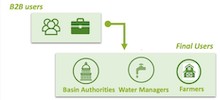
- To ensure the rational and sustainable use of water in its management area.
- Water management monitoring, using the concept of “Water Management Unit” (WMU).
- To defend and represent the interests of our farmers.
- Field inspections and surveillance, with sanctioning for exceeding the water rights.
- Application of innovative research into on farm impact
- Investigation into the applicability of new technologies
- Organisation and delivery of field days/workshops
- Engagement with farmer and industry representatives
- Partnership & Stakeholder Management Applied research on farms
- Imagery acquisition & converting this into on-farm decision making
- Integrating technology on farms
This is our team


")


ARIESPACE is an SME established as the first spin-off company of the University of Naples Federico II. With over 10 years of experience in the fields of Remote Sensing and Geo-information solutions, we provide products, services and consultancy for monitoring agricultural and forest resources based on satellite data.
ARIESPACE provides ready-to-use and user-friendly Decision Support Systems (DSS) based on satellite observations, geospatial data and biophysical models. Our aim is to fill the gap between currently availability geospatial tools and quantitative information needed to people working in field.
ARIESPACE experience has been established in the context of several national and international projects funded by EU (FP6 Pleiades, FP7 Sirius, FP7 Ceop Aegis).
AgriSat is a globally operating SME based in Albacete (Spain), founded in 2014 as a spinoff of a series of EU and national projects on decision support tools in operational irrigation and farm management. Some of its founders are among the world-wide pioneers of the technology and its integration with innovative co-creation and co-validation approaches.
AgriSat is an industry leader in operational and personalized services for irrigation advisory (irrimaps.com), fertilization advisory (fertimaps.com), and water management (hidrogestor.es). Its easy-to-use tools and products help farmers and agribusiness optimize water and nutrients as well as economic and ecological benefits.
The AgriSat team has long-standing expertise in the operational use of Earth observation (EO) and webGIS for water and nutrient management and farm advisory. Thanks to a collaboration agreement with the University of Castilla-La Mancha, AgriSat has access to continuous innovation in leading-edge technology and research capacities.
AgriSat’s founding partners and team members are an interdisciplinary group of agronomists, farm consultants, farmers, scientists, and ICT developers. Always connected to farmers and the land, it draws on 20 years of experience in large international and national projects in a wide range of environments spanning 19 countries in 4 continents.

UNSW Sydney is one of Australia’s leading research and teaching universities, with a focus on innovation in areas critical to our future – from climate change and renewable energies to breakthrough technologies and research to inform ecological sustainable development. Its 2025 strategic plan envisages a significant contribution to national prosperity through innovative, transformative partnerships with community, industry and government, facilitating the translation of research and education into economic and social benefits.
The generation and analysis of geospatial information (GI) is a critical component or even the focus of many research projects at UNSW, with active links with various external organisations that make extensive use of GI, including a number of government agencies, NGOs and the private sector, within Australia and overseas.
The Metternicht Lab (hosted by the School of Biological, Earth and Environmental Sciences) researches at the interface between science and policy, with experience in applied and translational research in environmental management and policy, and sustainability. The lab conducts highly inter-disciplinary research for the Sustainable Development Goals; and good policy and practices for landscape management.
")
The University of Melbourne (UOM) is a public research university and a member of the Group of Eight (Go8), Universitas 21, Washington University’s McDonnell International Scholars Academy, and the Association of Pacific Rim Universities. We are home to 100 centres and institutes for research and research training. Our largest campus in Parkville is part of the renowned “Parkville Precinct” knowledge hub, including 8 hospitals, leading institutes and a wide range of knowledge-based industries.
Established in 1853, the University of Melbourne is a public-spirited institution that makes distinctive contributions to society in research, learning and teaching and engagement.
The University of Melbourne consistently ranked among the leading universities in the world, with international rankings of world universities placing it as number 1 in Australia and number 32 in the world (Times Higher Education World University Rankings 2017-2018).
The University of Melbourne is a leading international university with over 160 years experience in teaching and research. Our student body consists of 47,000 students with an International cohort of over 11,800 students from 120 countries. The university is one of the largest employers in the state of Victoria with more than 6500 professional and academic staff spreading over seven beautiful and historic campuses.

UCLM is Public higher education and research entity. Remote Sensing and GIS Section is an interdisciplinary group of scientist and ICT developers, bringing expertise since 1996 on Remote Sensing and GIS-based methods for agro-environmental modelling, crop classification, mapping techniques, and webGIS platforms for services and interaction with end-users.
Remote Sensing-based crop water and nutrient management in precision agriculture.
Remote Sensing and GIS-based methods for agro-environmental modelling, crop yield, mapping irrigated surfaces, and interaction with users through webGIS platforms like SPIDERwebGIS®
A close collaboration during more than 20 years with farmers and water authorities to achieve a best crop management mainly in irrigated areas by using EO. This collaboration has led an operational EO-based service for irrigation water management, funded by the users, jointly with the river basin authority, which is running since 1998 (ERMOT project). Leading European projects, like H2020 FATIMA, www.fatima-h2020.eu, and other national and international projects.

ANBI Campania is one of 20 regional members of the National Association of Management and Protection of the Territory and Irrigated Waters (ANBI), which brings together all the Italian Consortiums. These, in turn, are public economic bodies, runned by all the owners (farmers and non-farmers) of lands and buildings placed in managed areas.
In Campania Region operate n. 10 “Reclamation Consortiums” – all enrolled in ANBI Campania. The Association connets and guides regional Consortiums in promoting and implementing:
The main task of Consortiums is to plan, to maintain and to coordinate both public and private works devoted to drainage, irrigation, flood control, soil defence, as well as works designed for environmental safeguard and restoring of waters (also for irrigation uses). Having almost completed drainage and irrigation networks, Consortiums are now mainly focused on the maintenance and renovation of existing irrigation systems and on irrigation control.
In the field of common irrigation, the Consortiums in Campania are adopting modern methods of irrigation management which, thanks to the elaboration of satellite images, provides the stakeholders with an ‘irrigation advice’ on water volumes to distribute both at irrigation district and farm level. The irrigation advice system adopted, called IRRISAT was presented and awarded at the Expo of Milan in 2015 among the ‘best practices’ on food safety
BOKU focuses on applied Earth observation (EO) and geo-spatial technologies related to agriculture, forestry and landscape planning (time series analysis, land use mapping, forest monitoring and mapping, landscape ecological interpretation, yield forecasts, drought monitoring).
Advanced modelling skills include:
The project team has developed operative solutions for large-scale satellite data processing for various agricultural applications, including transfer of technology (for irrigation, drought, yield monitoring). This includes the implementation of advisory services for agriculture. Data processed this way are currently used to assess crop water requirements in Austria (EO4Water), agricultural productivity in Brazil and to monitor drought occurrence and strength in Kenya, Austria, Germany & Switzerland. The team has also investigated and developed methods for the exploitation of new sensors data (e.g. PROBA-V, Sentinel-2 & -3 missions) and has a wide practical experience in field campaigns for validation of satellite products. Infrastructure at the Institute includes computer and software facilities for processing EO datasets. The institute owns proprietary code for time series (pre)processing and radiative transfer modelling.
The experiences deployed for this project includes the implementation, testing and operational execution of Sentinel-2 (S2A & S2B) data processing tailored to the needs of Irrigation Water Management. This will include the software infrastructure for S2 data processing, to run at the Earth Observation Data Center (EODC), which is federated with the WEkEO Copernicus Data and Information Access Services (DIAS)
JCRMO is a non-profit corporation that integrates about 9000 irrigator farmers who use ground or surface water in the area of Mancha Oriental, that Includes 7 groundwater bodies. It manages 130.000 ha in the middle course of the Júcar river basin, working together with the Water Authorities with 11 technical workers.
Our main job is the application of an Annual Exploitation Plan to every WMU, mandatory for all the farms and coordinated with the River Basin Authority. In order to control the quantity and location of irrigation water, we use Geographic Information Systems that integrate multiple layers of cartographic information, WMU, satellite images, etc.
Since it was established in Albacete (Spain) in 1995, we have taken part in numerous collaboration agreement with the Water Authority, University of Castilla-La Mancha, Technical Research Institutes and other entities. After 25 years we have now great skills and knowledge to manage 6.550 Water Management Units, 8.200 wells and 340 river pumpings.
Established in 1992, the Birchip Cropping Group (BCG) is a not-for-profit organisation led by farmers from the Wimmera and Mallee regions of Victoria, Australia. BCG aims to improve the prosperity of Australian broadacre farmers through applied science-based research and extension and has been recognised both nationally and internationally by the industry as a credible independent and innovative organisation. BCG has been integral in the adoption of new agronomic technologies and farming practices; and continues to help farmers make decision, develop risk management strategies, increase profits and operate sustainable farming operations
BCG offers the following services to our members:
Our staff have extensive experience with translating science into profitable on farm applications. We understand how technology or innovation can be integrated on farm, we know what tools and technologies are currently being utilised and we know the best ways to obtain great farmer engagement.

White Research (WR) is a social research and consulting SME specializing in consumer behavior, market analysis, business planning and innovation management. WR offers a tactical combination of research and business expertise in EU-funded research (FP7 and Horizon 2020 – IAs, RIAs and CSAs) and management consulting (including EU tenders) in several sectors, such as agriculture, earth observation, ICT, energy, transport and health.
Our staff has been involved in more than 35 EU-funded projects in various capacities conducting, among others, quantitative and qualitative research (EU-level multi-component surveys, interviews, workshops, webinars), literature reviews, policy analysis, development of recommendations, and expert consultation activities. In the frame of its market research activities, the company has undertaken the design and analysis of several international quantitative and qualitative surveys aimed at extracting end-user, innovation-related insights. At the same time the company has also acted as Innovation Manager in various H2020 IA, RIA and CSA projects, effectively engaging targeted stakeholders, executing business modelling and deploying planning activities, paving the way for the market uptake of project assets.
At its core, WR possesses valuable expertise in business support and innovation management services including market and risk analysis, business modelling and planning, commercial exploitation of research results and innovations.
Innovation Management; business supporting, modelling and planning; market and risk analysis; commercial exploitation of research results and innovations in several European funded projects (IA, RIA and CSA). Here a small selection of relevant previous projects or activities, connected to the subject of COALA project: DIANA (H2020, 2017-2019); InnoRate (H2020, 2019 – 2021); AgroBioHeat (H2020, 2019 – 2021); ISABEL (H2020, 2016-2018); Cities-4-People(H2020, 2017-2020); Study CIPTEC (H2020, 2015-2018); Health2Market (FP7, 2012-2015).

Irrigation Research and Extension Committee (IREC)
The Irrigation Research and Extension Committee (IREC) facilitates cross-industry collaboration and cooperation between all those connected with irrigated agriculture in the Murrumbidgee Valley – irrigators, researchers, industry, agencies, and government.
Irrigation Research & Extension Committee (IREC) is a trusted independent cross commodity farming systems group and has been a strong voice for irrigation excellence in southern NSW since 1939. IREC is a not-for-profit irrigated agricultural organisation with proven relationships with irrigation farmers, researchers and industry.
IREC provides a forum for irrigators, researchers and agribusiness to address issues of common interest and concern, relevant to irrigated agriculture in the Murrumbidgee.
Main services:
• Facilitate communication between farmers, advisors, researchers and industry
• Enable uptake of innovative on farm practices
• Identifying research and knowledge gaps
• Collaborate with industry and researchers to leverage research funds
• Extend new and innovative farm practices to irrigation farmers through field days workshops, social media or written format
Understand irrigated crops and farming systems, irrigation layouts and surface irrigation automation technology.
Skills and knowledge to collect, store, use and manage ag data.
Through our cross industry focus IREC has helped broad acre and horticulturalist irrigators to remain productive, profitable and sustainable through the adoption of new and often innovative ag practices as well as the uptake of cutting-edge technology. While the majority of the 560 membership is made of irrigation farmers, we also have a number of advisors, researcher and industry members.
External Partners & Collaborations
WIKIFARMER
Wikifarmer is a global platform with the mission of empowering farmers through educating them and offering them access to the open market to sell their products at fair prices.
COALA Project has a program of cooperation with Wikifarmer. The collaboration of both partners should enable each one to better achieve its respective objectives.
This is our Advisory Board

Marie WEISS
Institute National de la Recherche Agronomique (INRA) Scientist, EMMAH-UMR1114 – UMT CAPTE
Scientist, EMMAH-UMR1114 – UMT CAPTE
Dr. Marie Weiss is working at the French National Institute of Agronomic Research (INRA), in Avignon, France. She received an engineering diploma in signal and image processing from ENSEEIHT (Toulouse, France) in 1995 and a PhD (University of Nice Sophia-Antipolis, France) in 1998. Her main research interest is the development and the validation of algorithms for the estimation of biophysical variables such as leaf area index (LAI) and fraction of absorbed photosynthetically active radiation (fAPAR) from remote sensing data. She has been working on the development of operational products from European satellites (VEGETATION, PROBAV, SENTINEL2). She was also involved in designing instruments and softwares for proxy sensing (e.g. CAN-EYE, PASTiS, SCANAREA). More recently, she is focusing on very high resolution sensing by UAVs and mobile robots for applications in phenotyping contexts. She is also co-leader of the CEOS (Committee on Earth Observation Satellites) LPV (Land Product Validation) subgroup on fAPAR since 2017
Role in the project: external advisory board. The COALA project is close to my expertise & activities mixing research challenges (data fusion & scaling, assimilation) & application at the farm level with users involved
Really Excited to be part of the advisory board !
She provides independent suggestions on execution and carrying on of project

Norman MUELLER
GEOSCIENCE AUSTRALIA Environmental Geoscience
Director, Product Development, Digital Earth Australia Division

Brent WILLIAMS
Murray-Darling Basin Authority
General Manager Office of Compliance
Knowledge of water management legislation and operational arrangements in the Murray-Darling Basin, the application of remote sensing technology to improve water use efficiency and management outcomes
Extensive experience in and knowledge of Natural Resource and Conservation Management in Australia including Water Policy development and implementation in the Murray-Darling Basin, the use of remote sensing applications to support NRM applications and compliance.