- August 26, 2020
- Agrisat
- Blog
- No Comments
- Daily monitoring of crops through the AgriSatwebgis platform and time series of satellite images from the Copernicus program.
- Delimitation of farms in different management areas through Management Zone Maps (MZM). These maps divide the paddocks into zones with different productive potential. The zones allow different management of each area, allowing the farmer to be more efficient in resources.
- Periodic biomass maps.
- Maps representing the nutritional status of the farm using the Nitrogen Nutrition Index (NNI) derived from the satellite imagery.
- Performance maps in the final stages of the cultivation cycle.


COALA beginning a fruitful relationship – BCG & AgriSat
COALA beginning a fruitful relationship – BCG & AgriSat
COALA experts collaborate in Australian agriculture, beginning a fruitful relationship.
Agrisat
This blog will show how COALA experts collaborate in Australian agriculture, beginning a fruitful relationship. AgriSat is a Spanish agronomic consulting company based on new technologies such as satellite images and Geographical Information Systems (GIS). Located in Albacete, Spain, it is operating globally. Some of us from the AgriSat team were planning to travel to Australia earlier this year, to visit Australian partners involved with the COALA project, including The Birchip Cropping Group (BCG). BCG is a member-based not for profit agricultural research organisation led by farmers in the Wimmera and Mallee regions of Victoria, Australia.
Due to the coronavirus pandemic, our visit had to be transformed into a virtual journey, different from what we thought, but nonetheless exciting. Over the following paragraphs, we hope to share some of our experiences with you, including the work carried out so far by these two organisations to improve the agricultural management of crops and, therefore, the prosperity of farmers through farmer-driven innovation, research and extension promoted through the COALA project.
The Beginning
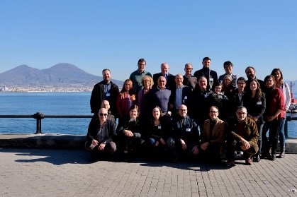
The relationship between BCG and AgriSat began in February 2020 during the Kick-Off Meeting of the COALA project held in Naples, Italy. During this meeting, there was a mutual interest in knowing the agricultural context of each other’s countries. As a result of that interest, AgriSat demonstrated their services and products in an agronomic context. Their demonstration included case studies from Spanish farmers who have applied this technology in their operations.

An example of one of the Spanish case studies
The products that were introduced to BCG centred around crop monitoring and fertiliser application. However, other products were also showcased including:
These products were then used to inform BCG members about the COALA project. The services that they hope to provide to Australian farmers to improve crop monitoring and nutrient management were also introduced.
Australian Case Studies
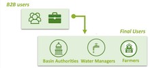
To test the value for Australian farmers, AgriSat through its relationship with BCG, has started engaging with individual producers to understand their production systems better. We are also engaging with a small number of initial users. Some of our products and services have been rolled out for their evaluation and validation.
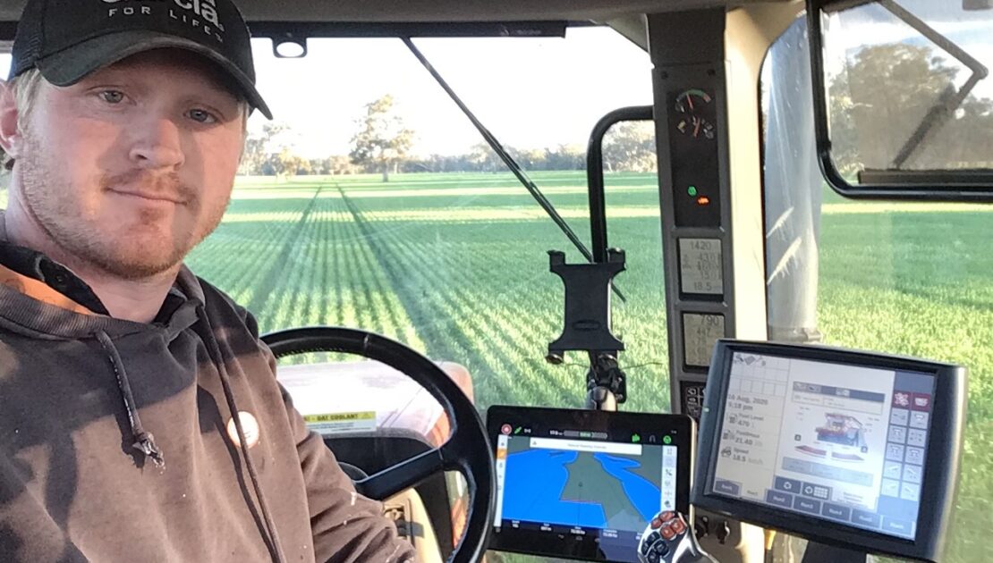
So far two local farmers, Cameron Taylor and Tim McClelland, have provided information and data from their 2019 growing season covering an area of 10,063 ha (88 paddocks).

This information has been integrated into the AgriSatwebgis platform (below). AgriSatwebgis is visible to a closed group that was set up for all of BCG’s participating growers to visualise and become familiar with the products and services.

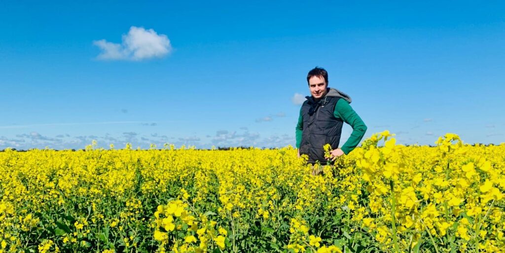
To date, the products that have been generated include the MZMs using data on dryland broadacre crops such as wheat, barley, canola, lentils, vetch, beans and oats.
An example of what the MZMs can look like is shown below. This particular map is of an 81.7 ha barley paddock on Cam’s farm. This Management Zone Map has been derived from averaged paddock yield data.
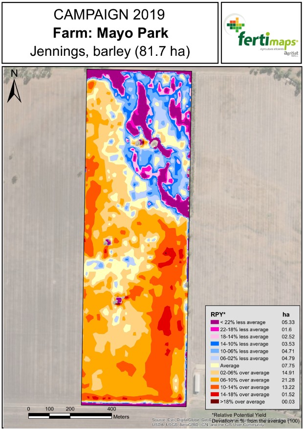
Possible applications of these maps include characterising the productive potential of each area of the paddock in each zone, which is a proxy of fertility and nutrient extraction. This application could help with planting and fertiliser plans as well as selective harvesting.
A total of 31 paddocks have had MZMs prepared. Both AgriSat and BCG are in the analysis and discussion phase for the evaluation and implementation of this product.
Existing Australian Platforms
Whilst BCG and Australian farmers were becoming familiar with the COALA project and the AgriSatwebgis platform, at the AgriSat team, we were learning about some of the existing platforms farmers utilise for making on-farm decisions in Australia. One such platform is Yield Prophet®. Yield Prophet® is an online crop production model that operates as a web interface for the Agricultural Production Systems Simulator (APSIM). Designed for grain growers and consultants, it matches crop inputs with potential yield in a given season to help users avoid over- or under-investing in their crop. BCG gave us an online demonstration of Yield Prophet® and later access to the portal for our own exploration.

To be continued…
The story of COALA beginning our fruitful relationship will continue to evolve over the next 2.5 years with the monitoring and generation of other possible products and services derived from Copernicus data concerning fertilisation and improving Biomass maps, the NNI or the Yield estimation services as it is described in the COALA project. Additionally, the same plots will be monitored using the Yield Prophet® tool to complement and improve agronomic advice with these new Copernicus products and services.